Crow Wing River Corridor Wildlife Management Area Hunting & access guide
Crow Wing River Corridor Wildlife Management Area is listed in the Minnesota DNR wildlife management area inventory near Nimrod. Review the agency’s area details and mapped restrictions before planning a hunt.
A discovery guide. Current agency rules and posted boundaries take priority.
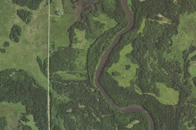 Aerial view · approximate location
USDA, USGS The National Map: Orthoimagery. Map services and data available from U.S. Geological Survey, National Geospatial Program.Image source Public-domain National Map CONUS imagery
Imagery date: Capture date varies
Imagery around this listing’s approximate map point. Surrounding public or private land may appear. This image is not a property boundary, entrance or hunting-access map. Resized for display.
Hunting area & landscape.
- State
- Minnesota
- Land designation
- Wildlife area
- Landscape
- Check the agency’s habitat and terrain map
- Approximate location
- 46.603° N, 94.835° W
Species in this listing
These tags help narrow your research. They do not establish an open season, a huntable population or permission to hunt this property.
Compare weapon & ammunition optionsHunting access & planning.
There is currently no access to the east side of the middle unit, except by river. The east side of the south unit is accessible by minimum maintenance road; however, there is no designated parking area. Please pull to the side of the road to park. Hunter walking trails and former logging trails provide good access to visitors. Wheel chair access to the unit is moderate to difficult. Primitive river access points are located on the north unit. Visitors can easily access the river from parking areas in the northwest and southeast sides of the north unit. The northwest parking area is gated and would require a short walk/portage to the river. Check current agency rules, seasons, permits, posted boundaries and closures before visiting.
Approximate discovery pin inside the largest mapped agency polygon; not an access point or hunting boundary.
Read the public-land planning guides